
Since the weather was clearing up, I decided to stop by the Mulholland Overlook to take a peak at the Los Angeles Basin. The view was more than I expected...

(Panoramic pic was taken with an my iPhone. Click the pic to get a BIG view)
This was the clearest view I've ever had of the city from the Mulholland Overlook. Due to smog, it's pretty rare to see Long Beach, the Palos Verdes Peninsula, and the Santa Monica Bay/Pacific Ocean from this view point. Unfortunately, the iphone camera didn't capture the ocean that well, but it's still somewhat visible. A Satellite map of the area in this pic can be seen here.
Also, on the punk history and geography tip, this is where Brendan Mullen gives his spiel in the Decline of Western Civilization. If you take the time to watch his bit from this link (starts @ 30 seconds), notice how you can barely make out downtown L.A. in the background from this same exact point.
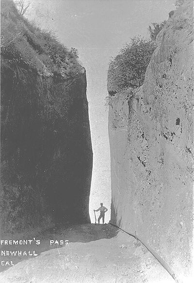
Since the rain was clearing up at the end of the day, I made a quick stop by Beale's Cut once the rain subsided. Located in between the Santa Susanna and San Gabriel mountains, the cut was the original connecting route between the San Fernando and Santa Clarita Valleys.

Originally cut into a 30 ft deep pass in 1854, the Surveyor General of California deepened the cut to 90 ft, and then named it after himself-- pretty baller.
As a kid going to school in the SCV, this place was brought up a lot as a local point of interest especially whenever we went on field trips to the SCV Historical Society museum.
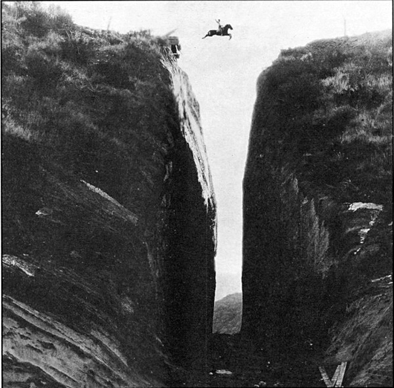
Oddly, we never actually went on a field trip to this place, so I mostly remember it as our favorite funny historical pseudo-pun, "Beale's Butt." The above picture is one of the most well known of the cut, a cut and paste composite of early Western star Tom Mix. Yeah, he didn't actually jump Beale's Cut.

This was my first time getting to see it up close. Unfortunately, it had caved in sometime in the late 90's so it's not quite the cut it used to be. You could say it wasn't quite cutting it anymore!

Here's the cut as seen from the backside, after I climbed up and over it. The caved-in area can be seen in the middle of it.

View of SCV and old Newhall refinery from the Beale's Cut road.

The 14 freeway as seen from Beale's Cut/Newhall Refinery Rd.

I have no idea exactly what this is, but I'm assuming it was made while deepening the cut.

Since it had just rained, all of the surrounding landscape was still ridiculously moist. These are the most ideal conditions for Southern California's infamous landslides and rockslides to occur. So, of course, only on the way back did I see this huge crack in the cliff face on south side of the cut, which scared the crap out of me, and made me realize how stupid it was of me to go here by myself. I'm lucky I wasn't engulfed in a sandstone rockslide.

Plaques for the site had been located on these monuments since the late 30's. Unfortunately, like most isolated interpretive sites, this one had fallen victim to vandals, so they have since been removed. Also -- surprise, surprise -- apparently there was a lot of illegally waste dumping at the site, so it was surrounded by an ugly, slapdash chain link fence. Bummer.
Needless to say, I miss California.

No comments:
Post a Comment